

Home / SERVICES
Our services.
reporting, and the right platform for the job.
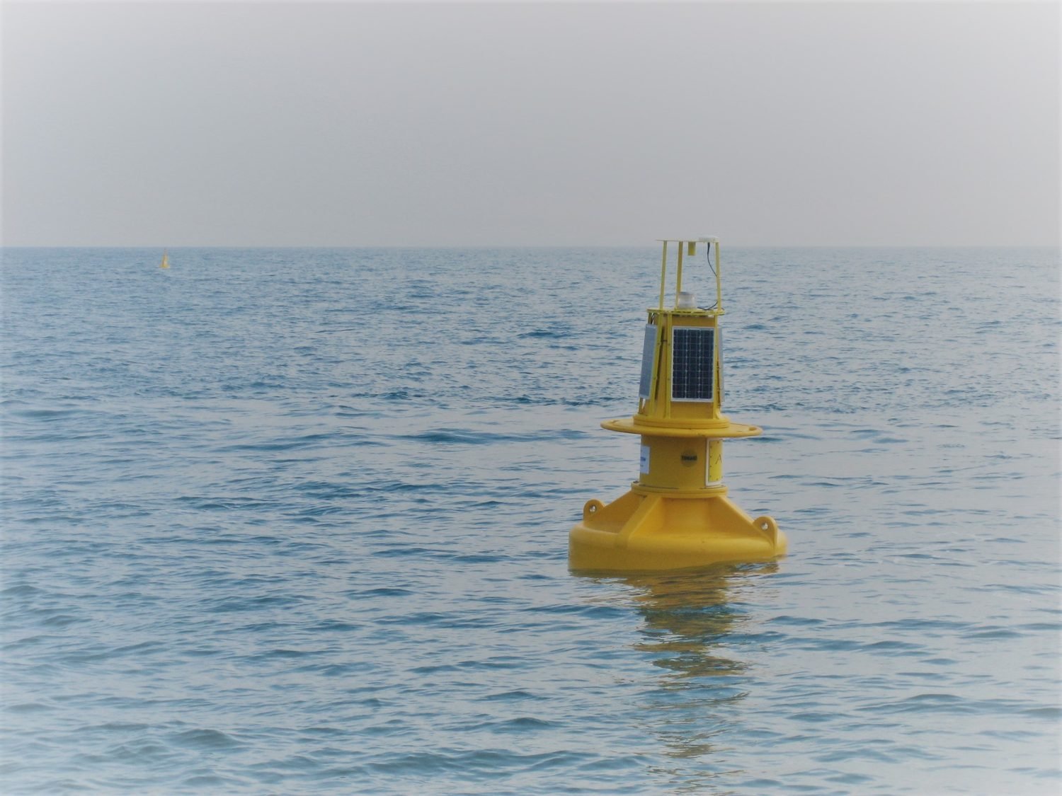
01 — Metocean
Metocean and
Environmental Monitoring
We deliver marine environmental monitoring programs including water quality monitoring, oceanographic measurement, water sampling, sediment sampling, benthic habitat mapping and environmental baseline studies. These services support approvals, compliance, impact assessment, construction monitoring and long-term environmental management.
Water Quality Monitoring
Structured water quality monitoring programs using field instrumentation, sampling and laboratory analysis to assess environmental conditions, compliance requirements and change over time.
Oceanography
Wave, current, tide, water-level and metocean monitoring using proven oceanographic instruments to support design, operations, environmental assessment and marine planning.
Water Sampling & Analysis
Targeted water sampling programs with controlled field collection, laboratory analysis and clear reporting outputs for environmental assessment and regulatory support.
Benthic Habitat Mapping
Benthic habitat mapping using underwater imagery, geospatial analysis and habitat classification to support marine planning, approvals and environmental management.
Sediment Sampling & Analysis
Sediment sampling and analysis to characterise seabed composition, contamination status and benthic conditions for environmental and engineering assessments.
Data Portals & Digital Twins
Project data portals and digital visualisation environments that bring survey, monitoring and inspection data into clear, accessible interfaces for review and decision-making
02 — Acoustics
Subsea Acoustic Monitoring
and Assessment
We provide fixed-station and dynamic passive acoustic monitoring, underwater noise assessments, vessel acoustic signature measurements and acoustic data analysis. Our work supports baseline soundscape characterisation, vessel and construction noise assessment, marine fauna studies and regulator-ready underwater noise reporting.
Fixed Station Passive Acoustic Monitoring (PAM)
Fixed-station passive acoustic monitoring using calibrated underwater recorders to characterise ambient sound conditions, vessel noise, construction activity and temporal changes in the underwater soundscape.
Dynamic Passive Acoustic Monitoring (PAM)
Mobile passive acoustic monitoring using towed or vessel-integrated systems to detect, map and characterise anthropogenic and environmental sound sources across active survey areas.
Vessel Acoustic Signatures
Vessel acoustic signature assessments using controlled pass-by measurements and recognised underwater noise standards to support impact assessment, compliance and vessel characterisation.
HD/IR Sea Surface Surveillance
High-definition and thermal sea-surface surveillance systems for day-night monitoring of marine fauna, vessel activity and surface conditions during marine operations.
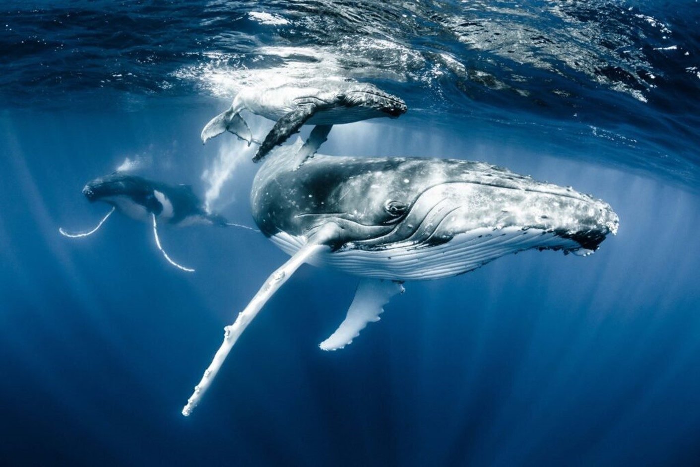
03 — Marine Fauna
Marine Fauna Monitoring
and Mitigation
We support marine fauna observation, passive acoustic monitoring for vocalising fauna, HD and infrared sea-surface surveillance, and field-based mitigation programs. These services are designed to assist with environmental approvals, construction monitoring, operational risk management and marine fauna protection requirements.
Fixed Station Passive Acoustic Monitoring (PAM)
Fixed-station passive acoustic monitoring using calibrated underwater recorders to detect marine fauna vocalisations and assess temporal patterns in biological acoustic activity.
Dynamic Passive Acoustic Monitoring (PAM)
Mobile passive acoustic monitoring using towed or vessel-integrated systems to detect, track and support real-time assessment of vocalising marine fauna during survey or construction activities.
Marine Fauna Observations
Marine fauna observation programs supported by trained observers, digital reporting tools and real-time field data capture for reliable operational and environmental records.
HD/IR Sea Surface Surveillance
High-definition and thermal sea-surface surveillance systems for day-night monitoring of marine fauna, vessel activity and surface conditions during marine operations.
04 — Geophysical
Hydrographic, Geophysical and
Topographic Surveys
We undertake shallow-water hydrographic survey, side-scan sonar survey, sub-bottom profiling, search and recovery support, and coastal topographic survey. These services support engineering design, dredging, asset management, seabed characterisation, coastal infrastructure projects and post-event condition assessment.
Sub-Bottom Profiling
Sub-bottom profiling surveys to identify shallow subsurface seabed layers, buried features and geological structure for engineering, environmental and planning applications.
Shallow Water Hydrography
Shallow-water bathymetric surveys using vessel, USV and GNSS-integrated systems to map nearshore seabed levels, channels, infrastructure interfaces and coastal survey areas.
Side Scan Surveys
Side scan sonar surveys from vessels, USVs or UUVs to image seabed texture, identify objects and support habitat, infrastructure and search investigations.
Search & Recovery
Targeted search and recovery operations using sonar, positioning, ROV and vessel-based systems to locate, inspect and recover underwater objects of interest.
Topographic Surveys
High-accuracy coastal topographic surveys using LiDAR, UAV/drone mapping and conventional land-based methods to capture shoreline levels, vegetation extents and key terrain features.
Data Portals & Digital Twins
Project data portals and digital visualisation environments that bring survey, monitoring and inspection data into clear, accessible interfaces for review and decision-making
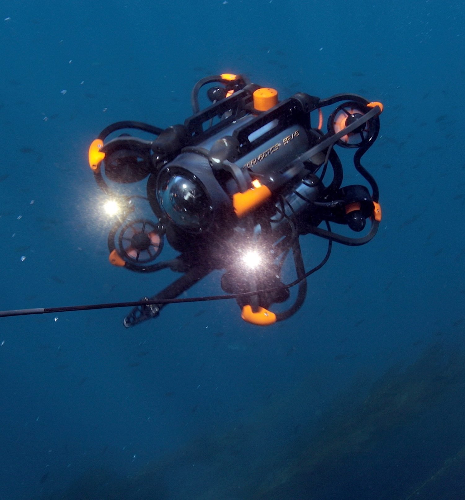
05 — Inspection
Structural Inspection
and Asset Integrity
We provide inspection services for port infrastructure, vessel hulls, tanks, pipelines, cables and other marine assets. We use a combination of vessel-based systems, ROVs, UAVs, imaging systems and specialist sensors to support asset condition assessment, maintenance planning and integrity management.
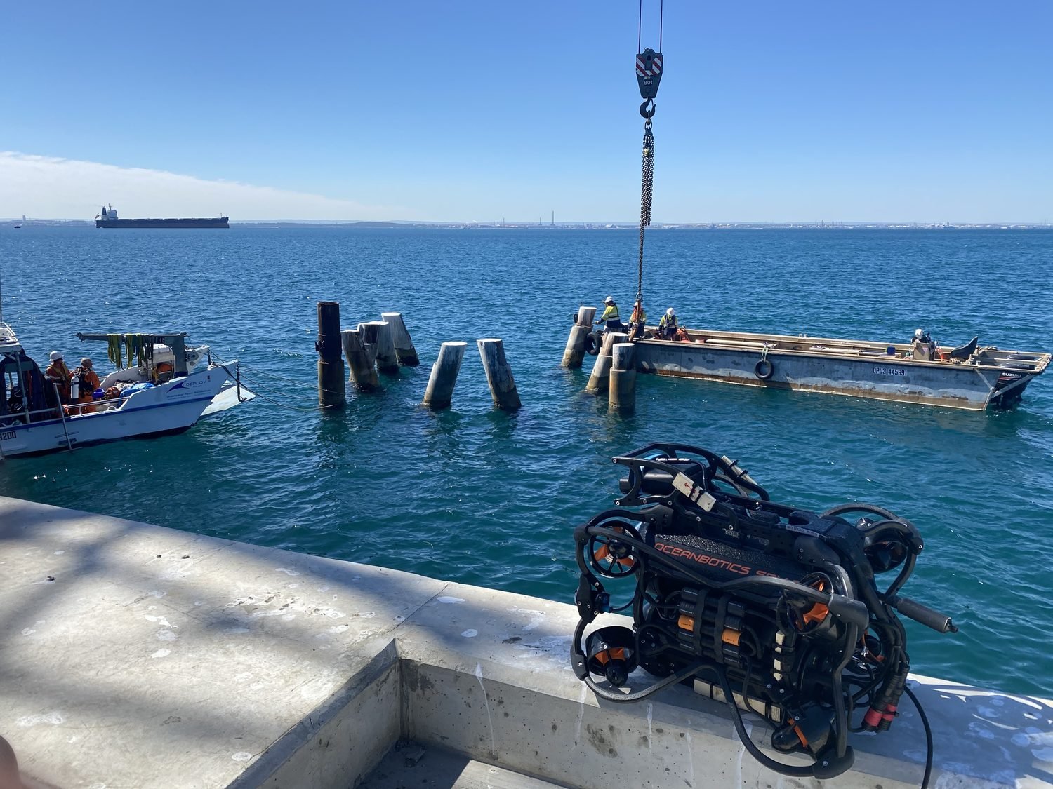
Port Infrastructure Surveys
Above and below water inspection of port infrastructure using UAV, vessel, ROV and imaging systems to assess asset condition and support maintenance planning.
Vessel Hull Inspection
ROV based vessel hull inspections delivering underwater visual records of hull condition, appendages, intakes, anodes and other submerged structures.
Tank Inspections
ROV-based tank inspections providing internal visual assessment of submerged or confined assets while reducing the need for full drainage or personnel entry.
Pipeline & Cable Surveys
Pipeline and cable route surveys using ROV, UUV, sonar and positioning systems to support route planning, inspection, burial assessment and integrity reporting.
06 — Data Engineering
Data Engineering and
System Integration
We develop data portals, remote reporting dashboards, digital twins, automated QA/QC workflows, machine-learning-assisted data processing tools and customised hardware or software systems. This capability allows us to improve the speed, consistency and transparency of marine data delivery.
Data Portals & Digital Twins
Project data portals and digital visualisation environments that bring survey, monitoring and inspection data into clear, accessible interfaces for review and decision-making
Remote Reporting Dashboards
Remote reporting dashboards providing near-real-time visibility of field operations, monitoring data, QA/QC status and key project metrics.
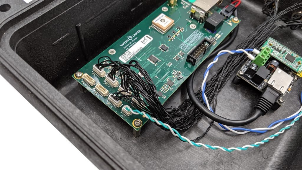
System Integration Services
Integration of marine sensors, positioning systems, telemetry, software and reporting workflows to improve field efficiency and data reliability.
Machine Learning & AI Data
Processing
Machine learning and AI-assisted workflows for rapid screening, classification and interpretation of large marine datasets, with technical review retained where required.
Customised Hardware
Custom hardware and field system adaptations designed to solve practical marine survey, monitoring and deployment challenges.
Data Portals & Digital Twins
Project data portals and digital visualisation environments that bring survey, monitoring and inspection data into clear, accessible interfaces for review and decision-making
Engage
Need a tailored scope?
Most engagements blend two or more service lines. Let’s design the right one with you.